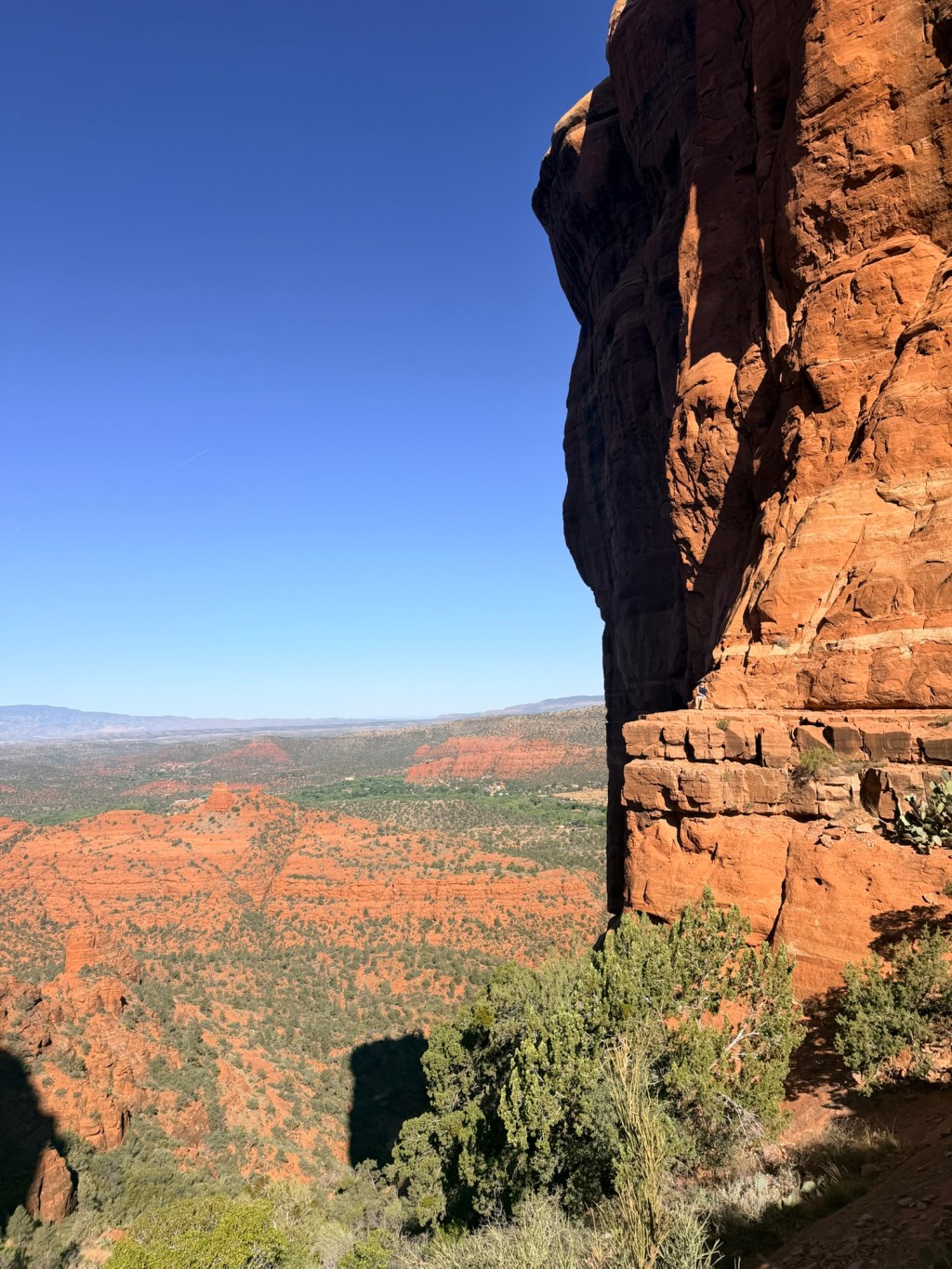
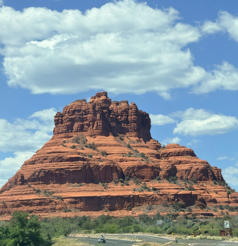
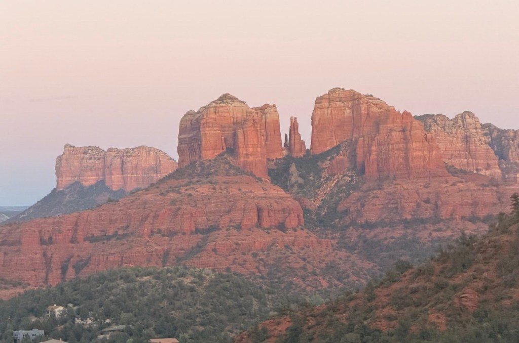
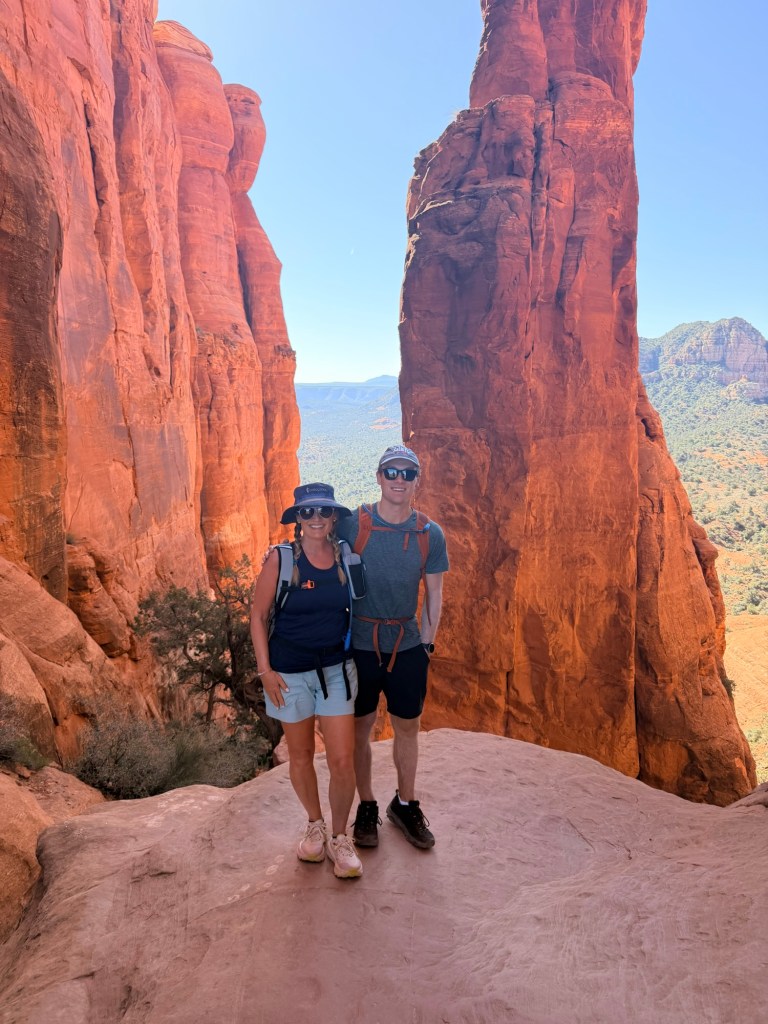
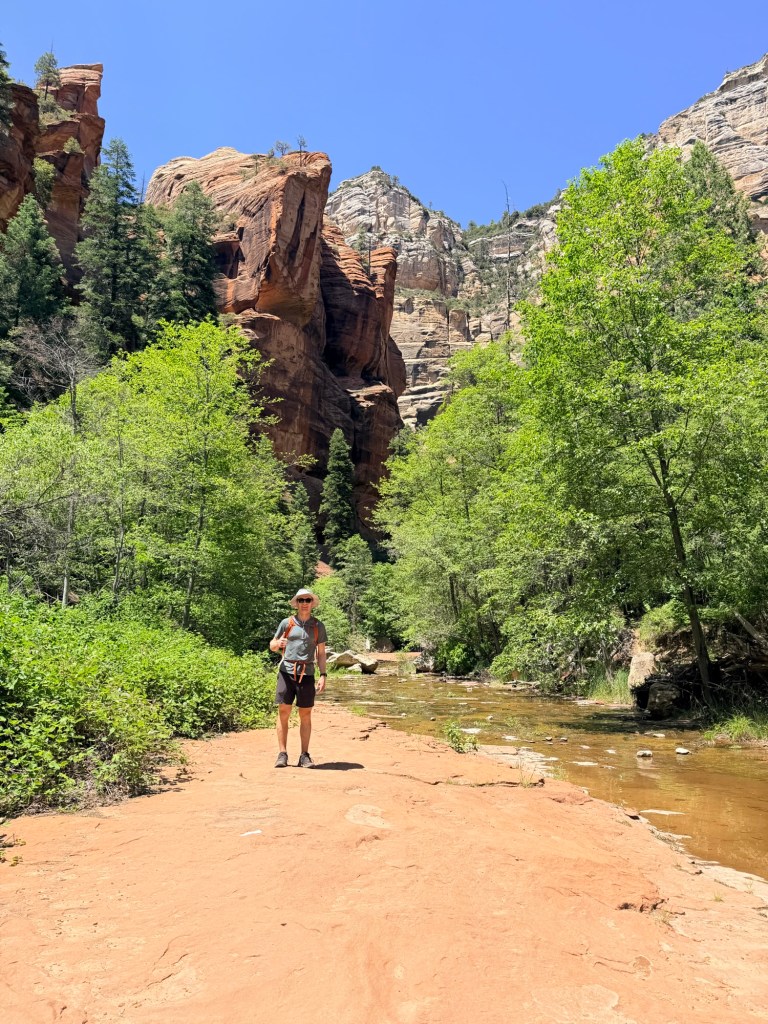
Some weekends are made for catching up on chores…not! Mother’s Day weekend took me to one of my favorite places on Earth🌎…Sedona, Arizona. There’s just something magical about those red rock landscapes that keeps calling me back. We mixed in a few favorites with some new discoveries…hiking Cathedral Rock and then Oak Creek Canyon, a new trail that didn’t disappoint. Spending Mother’s Day with one of my boys, making memories on the trail, is something I’ll never take for granted.
Cathedral Rock🧡Oak Creek Canyon🌳🌲
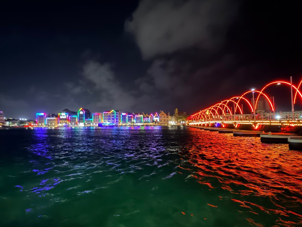
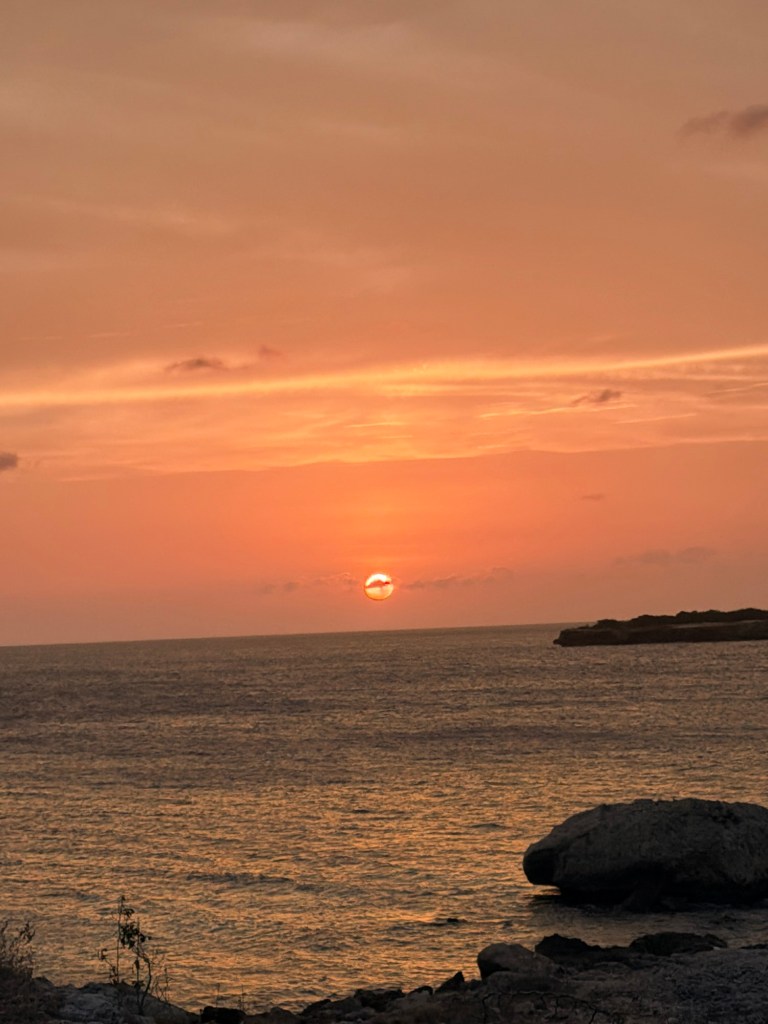
Before I had a chance to unpack, Memorial Day weekend took us to the amazing island of Curaçao. Crystal-clear water, warm Caribbean sunshine, and island life…there are certainly worse ways to spend a long weekend. It was just enough time to recharge before jumping back into reality.
Queen Emma Bridge in CuracaoA beautiful Curacao sunset 🌅
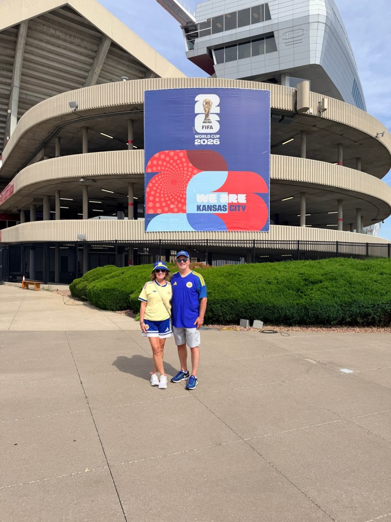
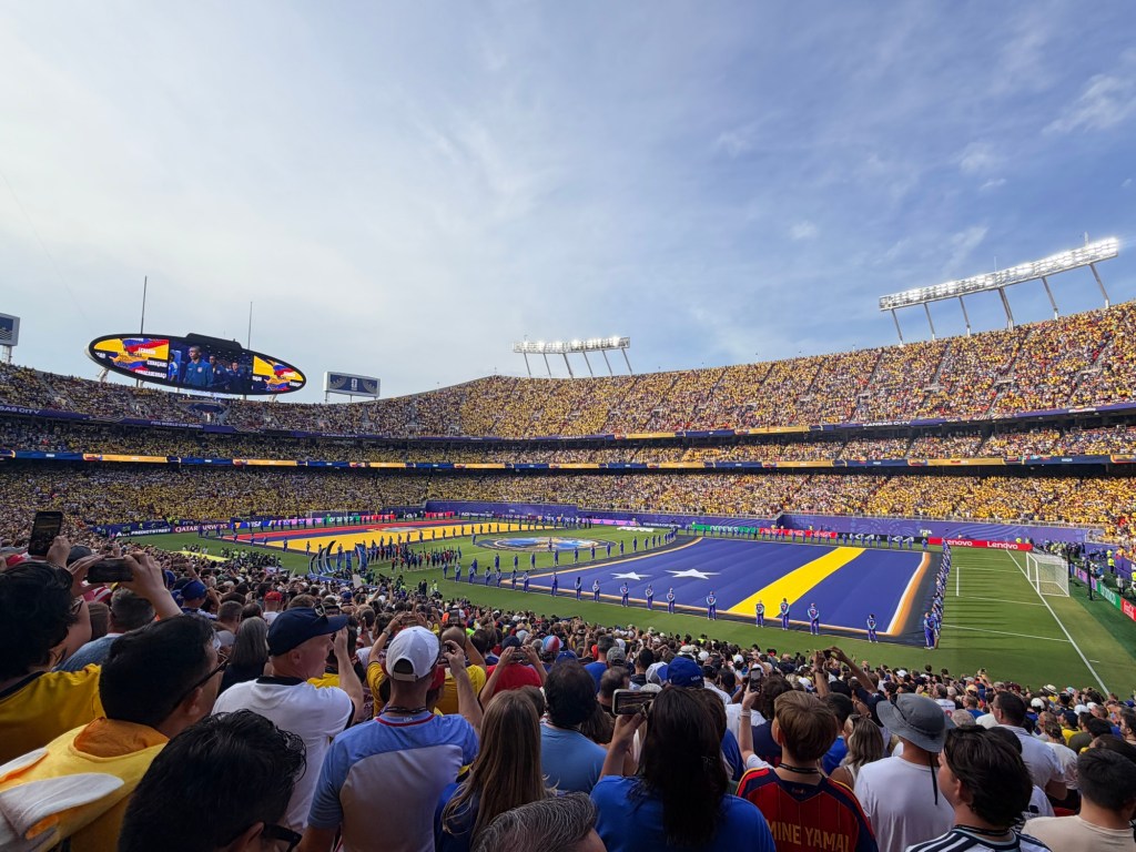
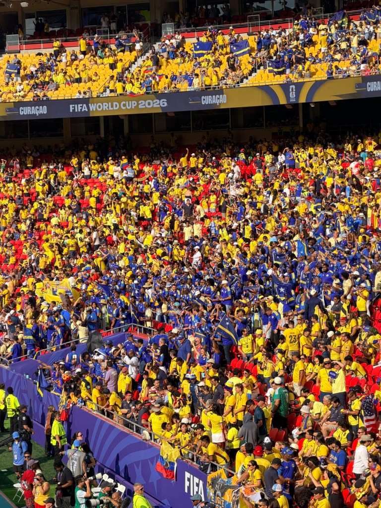
Then came another quick getaway, this time to Kansas City for something completely different: cheering on Curaçao in their first-ever FIFA World Cup appearance. Wearing yellow and blue, surrounded by passionate fans, and watching a country of just over 158,000 people take the world stage was something special. The final score almost became secondary. It was about believing, celebrating, and being part of history.
Fútbol ready in Kansas City! Curacao 🇨🇼 vs Ecuador 🇪🇨 Final 0-0 (Curaçao’s 1st World Cup point!)The Blue Wave 💙🌊💛 Cheering on Curaçao’s goalie, Eloy Room, who shut the door on Ecuador.
Looking back, May and June weren’t about long vacations. They were about saying “yes” to weekends that became memories. Sometimes the best adventures don’t require weeks away. All you need is a free weekend, a boarding pass, and a “just go” attitude!
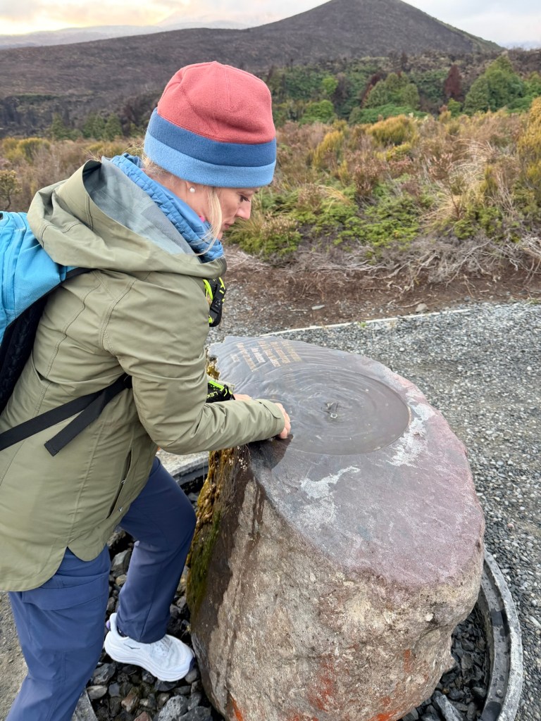
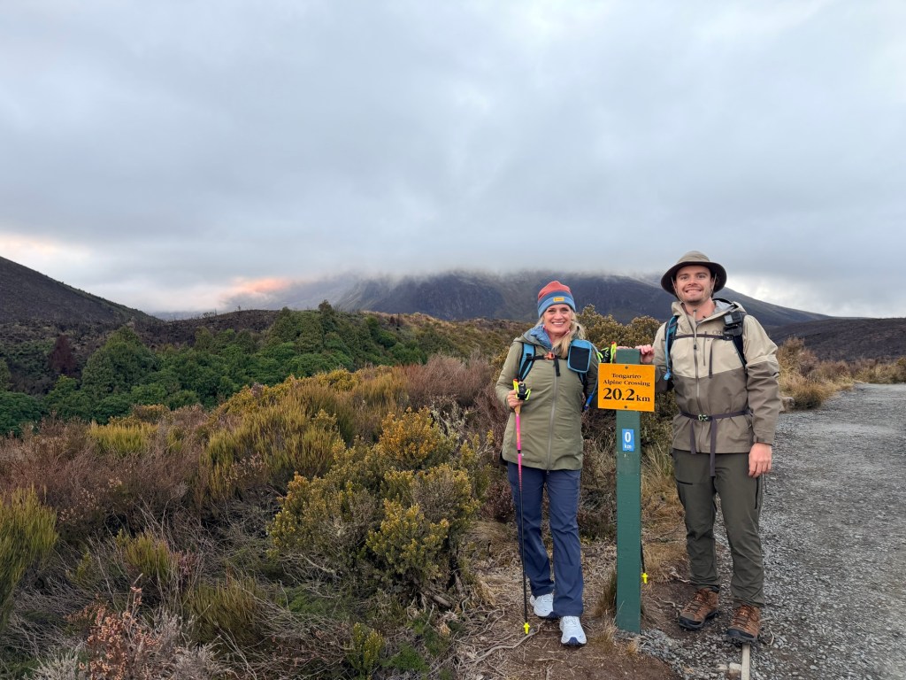
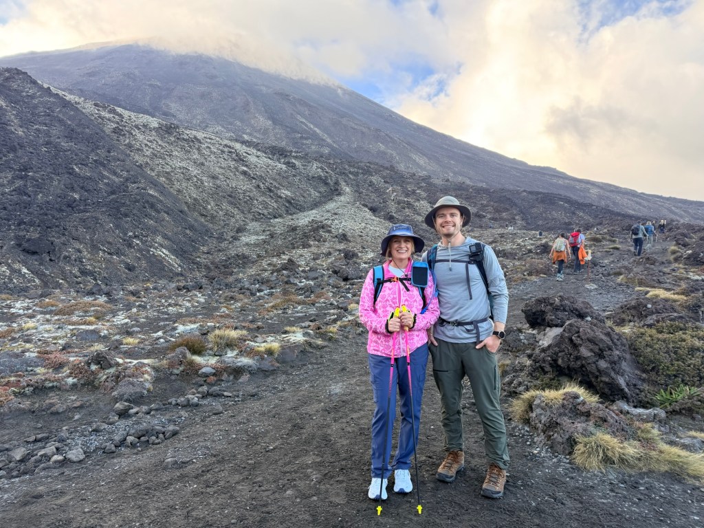
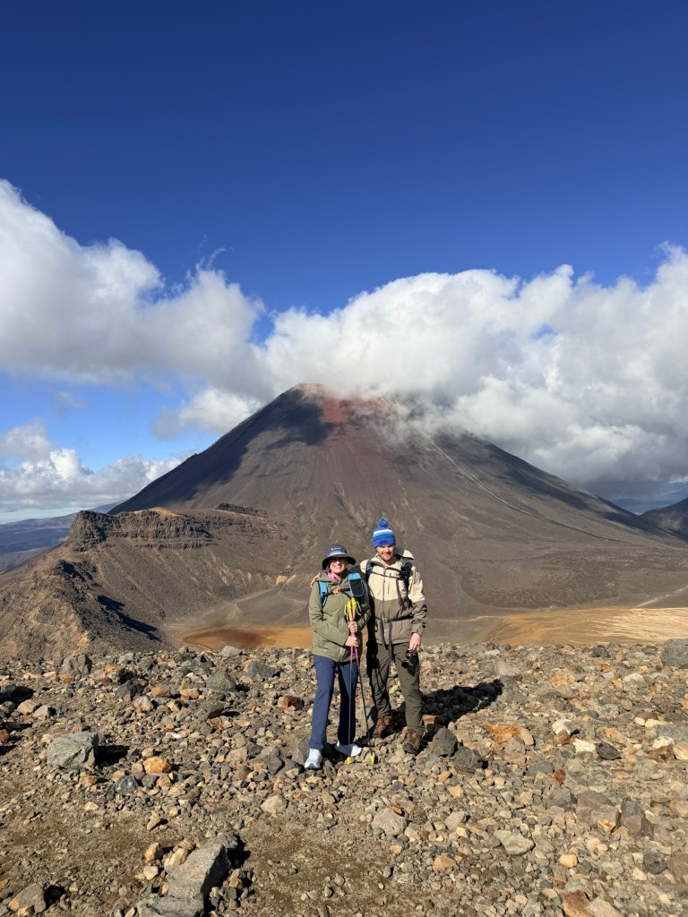
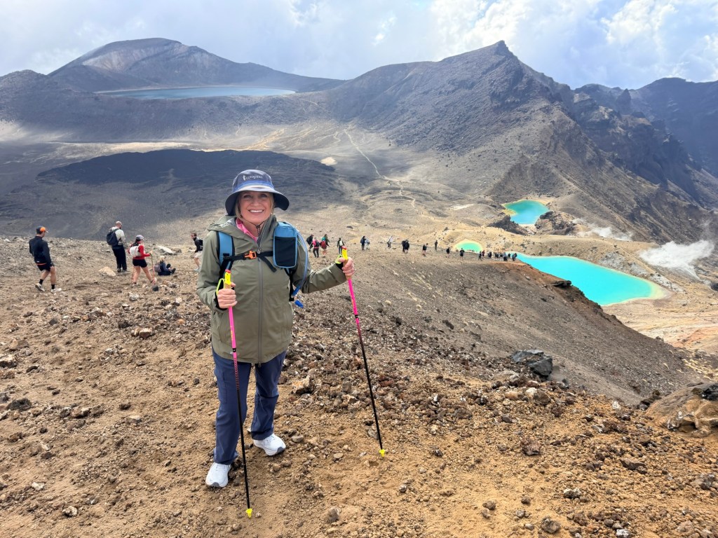
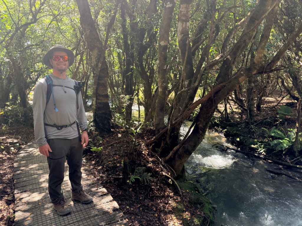
We set off at 7:30 am for the 20.2 km (~12.6 mile) hike on the Tongariro Alpine Crossing. Before we even took our first step on the trail, there was a quiet moment that felt different from every other hike we’ve done.
At the start, there was a small ceremonial bowl of water. Brendan and I paused and washed our hands—simple, quick, but meaningful. In Māori culture, this connects to the idea of moving from tapu (sacred) to noa (balanced, safe to proceed). It’s a way of acknowledging that this land isn’t just beautiful—it’s spiritually significant.
And standing there, about to hike (aka tramp) across an active volcanic landscape considered sacred, it felt like more than just a gesture. It felt like a reminder to tread with respect.
Then we tightened our packs and set off on one of the most challenging and stunning hikes we’ve ever done.
Ready to go!🚦
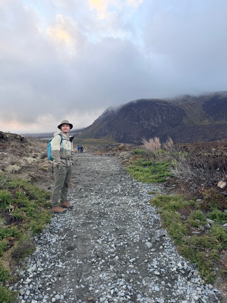
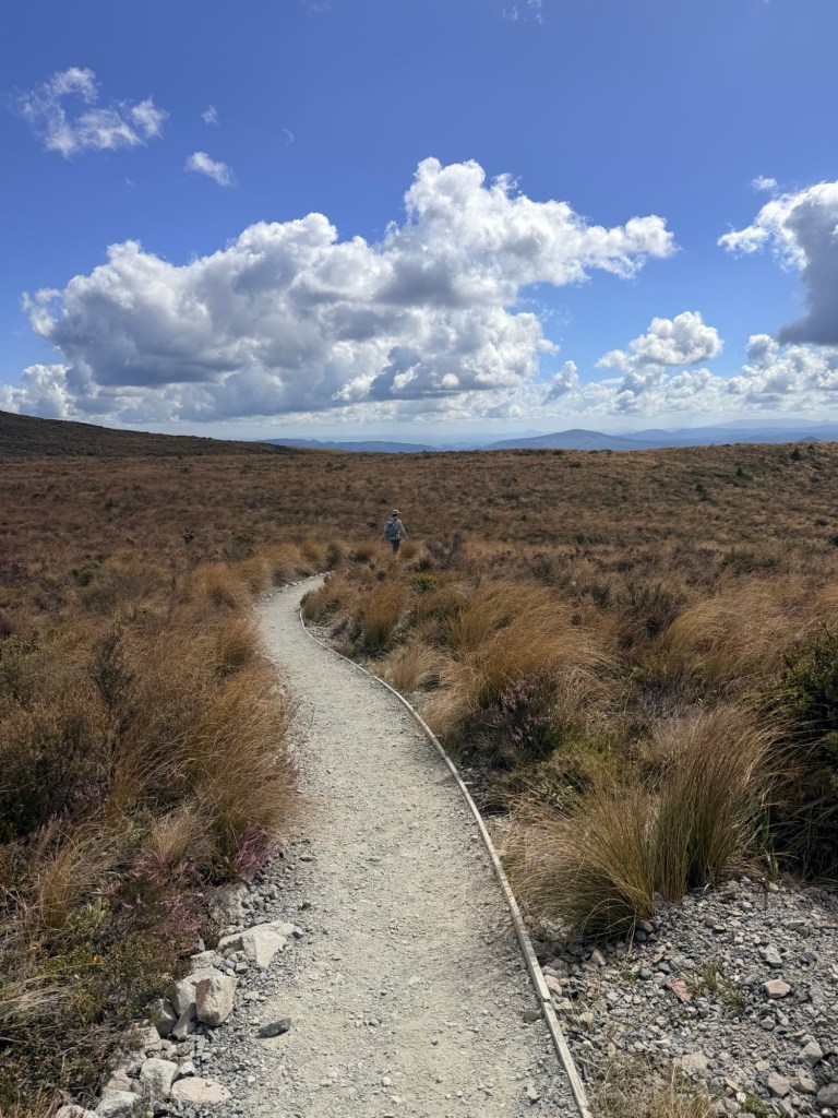
🌿 The Gentle Lie: Mangatepopo Valley (The Beginning)
We started optimistic, energized and slightly overconfident. The trail eased us in with a relatively flat, boardwalk-style path through the Mangatepopo Valley. It’s scenic, open, and led us to believe this was going to be manageable.
We chatted. We admired the views. We said things like,
“Wow, this isn’t bad at all!”
Lol. The innocence.
🪨 The Reality Check: Soda Springs to Devil’s Staircase
Enter: The incline.
The climb up to Soda Springs woke up our legs, but it’s the Devil’s Staircase that officially humbled us (well, maybe me more than Brendan). A relentless series of steep steps that felt like you’ve truly arrived in Hell.
At this point our conversation decreased, our breathing increased, and layers started coming off (turns out five layers was ambitious).
Lots of stairs. Lots and lots of stairs. And more stairs.
And yet, you look up and the landscape is already becoming otherworldly.
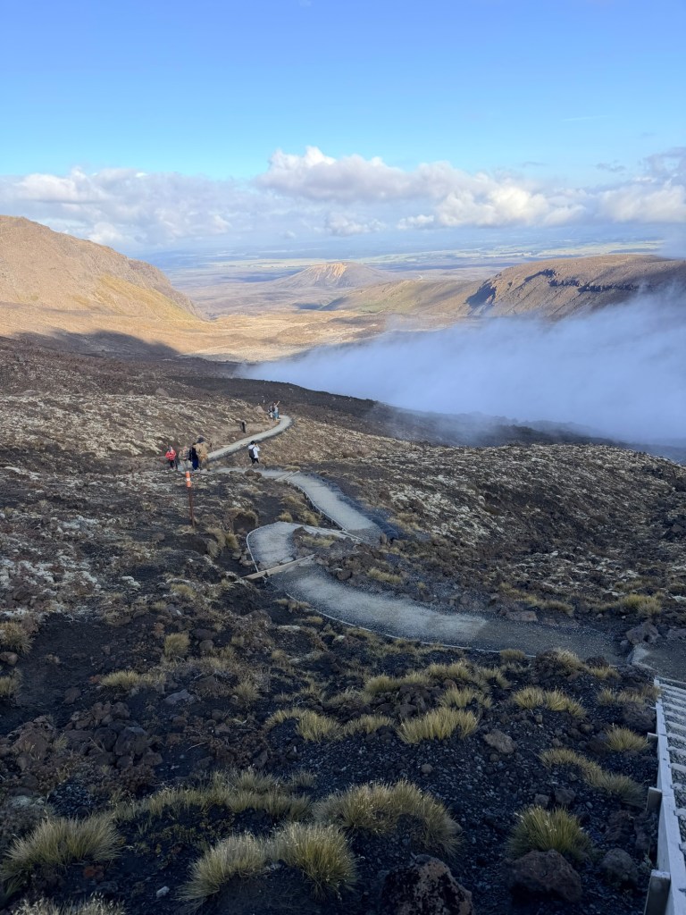
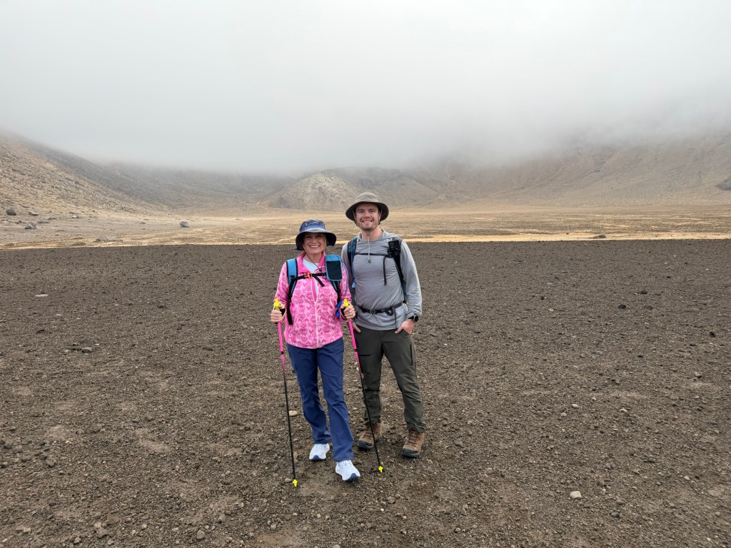
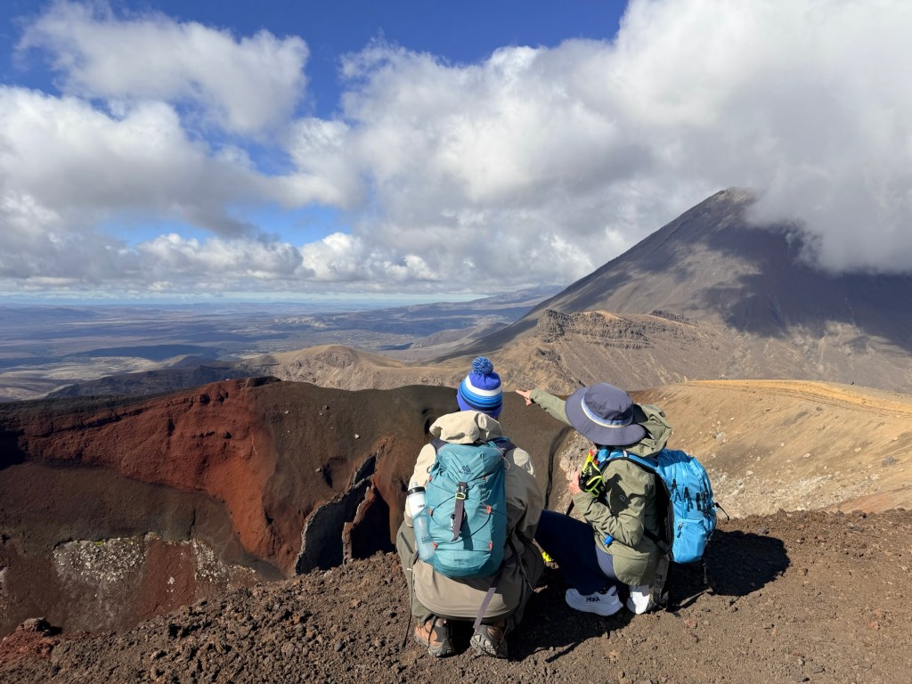
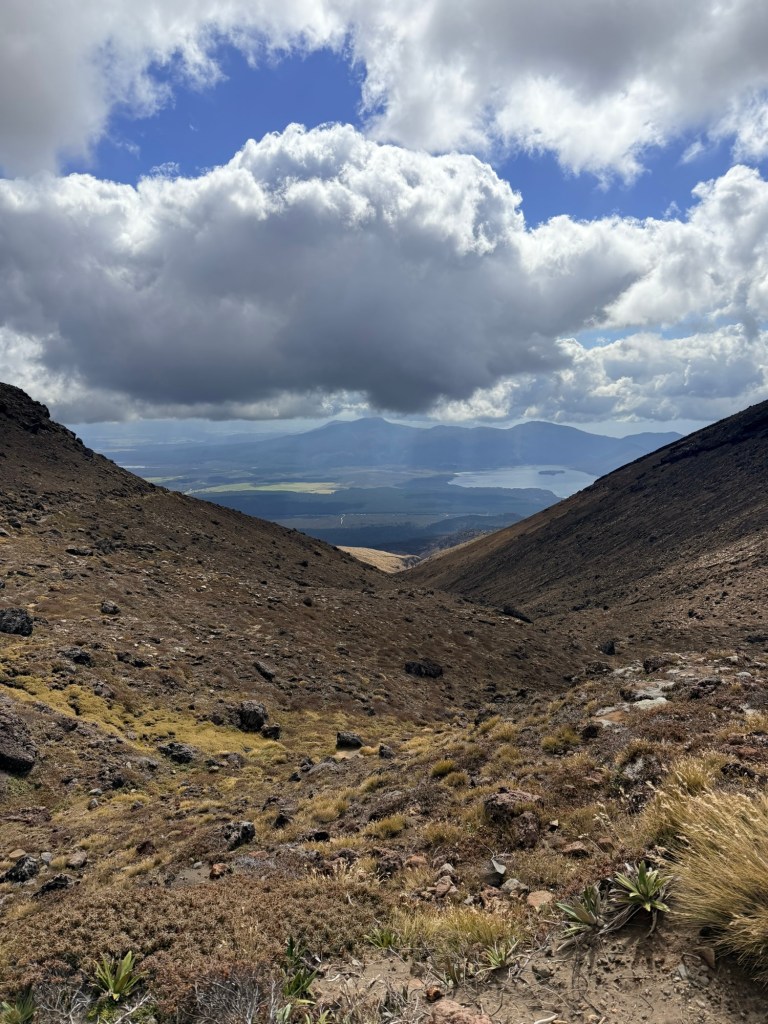
🌋 The “Why Are We Doing This?” Section: South Crater & Red Crater Climb
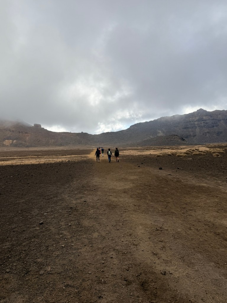
We got a brief reprieve crossing the South Crater—a wide, flat expanse that feels like walking on another planet.
Eventually we walked in that same cloud behind us once we ascended.
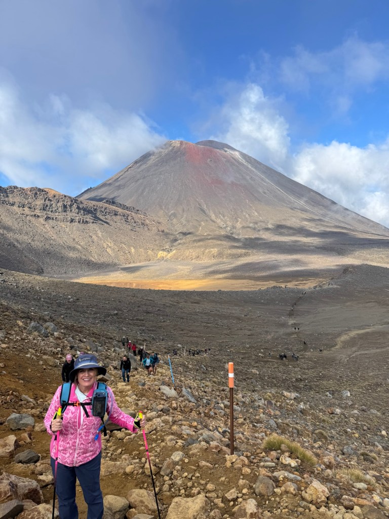
Then we saw it.
The climb up Red Crater.
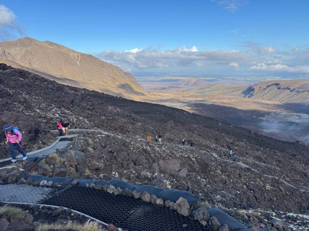
Holy moly. THAT WAS HARD. In fact, there’s even a sign after the Devil’s Staircase that says it’s about to get even harder, so if you want, turn back now.
It is definitely the hardest cardio part of the hike. It’s steep, loose, and requires equal parts determination and stubbornness. I didn’t think it was going to end.
There was pain on that face disguised with a smile 😊
But when we finally reached the top and stood at the highest point of the crossing, we were surrounded by raw volcanic beauty that made us forget (temporarily) how hard that really was.
💨 The Descent That Tests Your Balance: Red Crater to Emerald Lakes
Going down sounds easy. It is not.
The descent is steep, covered in loose volcanic gravel, and feels like walking on marbles. It’s less “hiking” and more “controlled sliding while trying to look graceful.”
This is also where my hiking poles officially became MVPs. Absolute lifesavers on the downhill—10/10 recommend if you enjoy having functional knees. Thank goodness for them otherwise I may have gone right off the edge. So many people were sliding and falling down, Brendan and me included.
But then—just as we’re questioning everything—we see them…
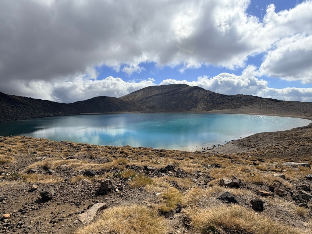
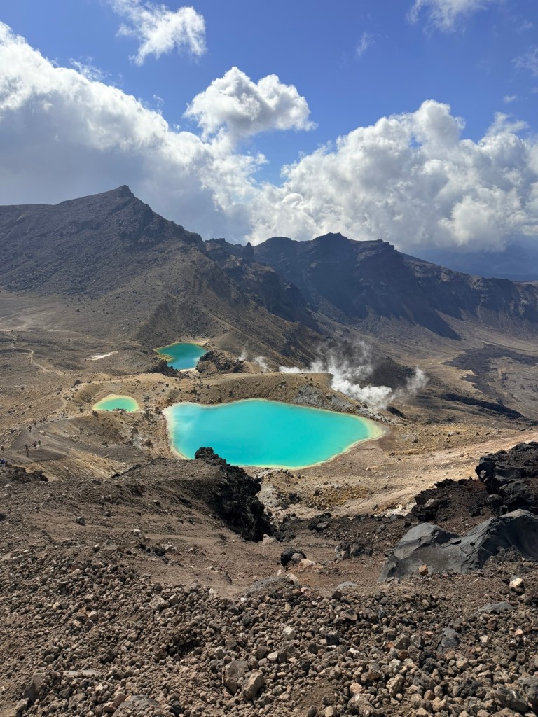
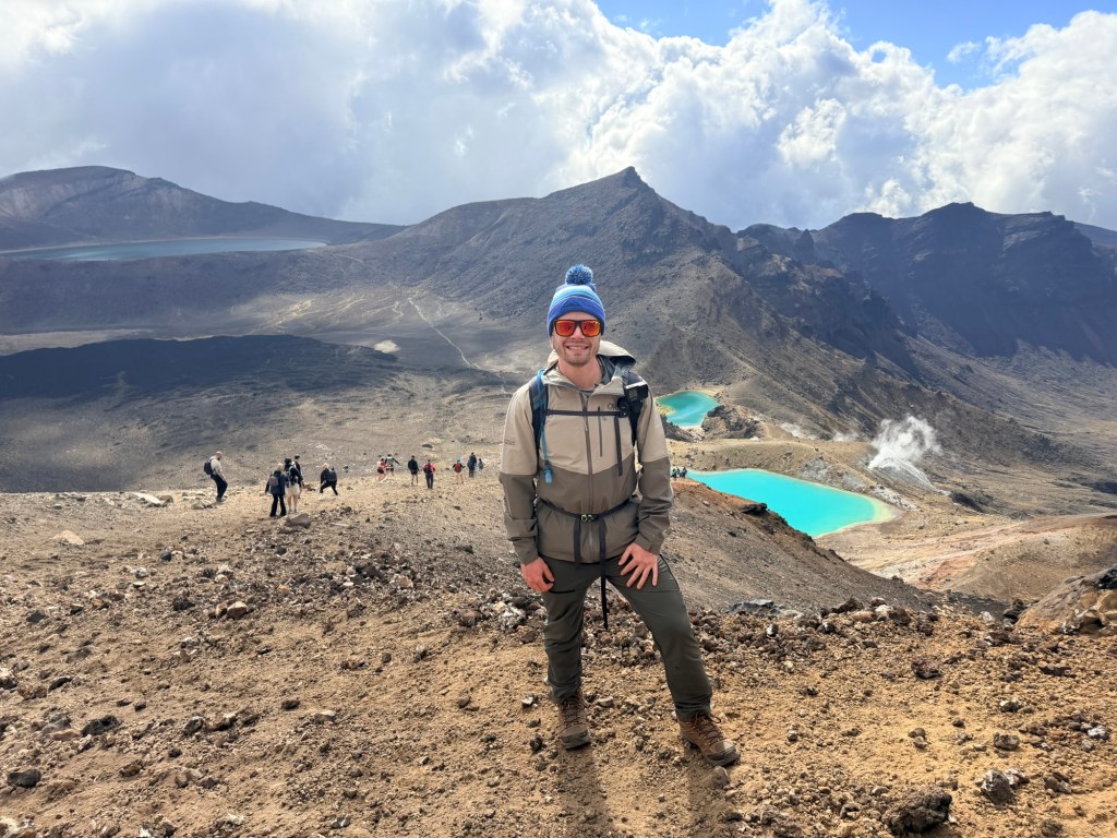
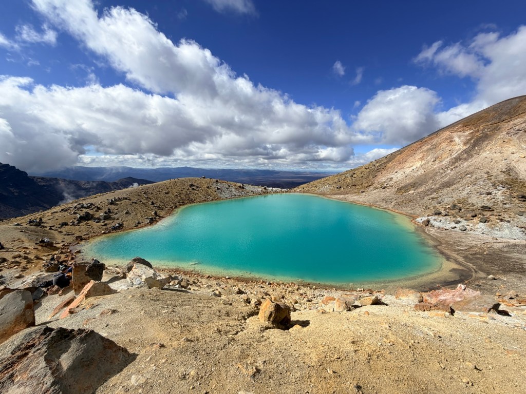
💚 The Showstopper: Emerald Lakes
Bright, surreal, almost impossibly green.
The Emerald Lakes look like they were photoshopped into real life. The contrast against the dark volcanic terrain is unreal! Suddenly everyone forgot their exhaustion and turned into a photographer.
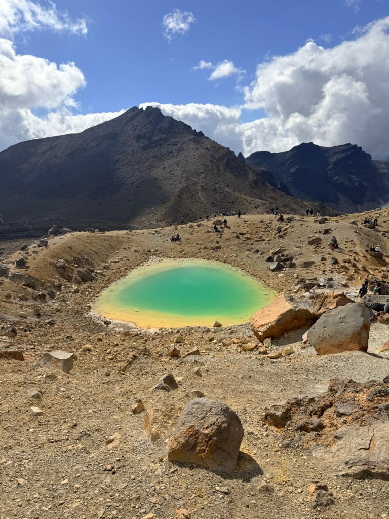
First glimpse of the 3 Emerald Lakes! Take a look at that downhill slide…everyone was stumbling and falling.That is steam coming up from the ground, which is created by groundwater that is heated by magma. It is also called a fumerole emission.
This is where we paused. Took it in. Smelled the sulfur. Wonder how something this harsh can also be this beautiful.
The stunning green color comes from dissolved minerals, including sulfur and calcium carbonate leaching from the thermal area.
Take a closer look at the lakes (and the path to get to them😳)
🩵 The Long Way Home: Blue Lake to Ketetahi Descent
From here, the hike shifted yet again.
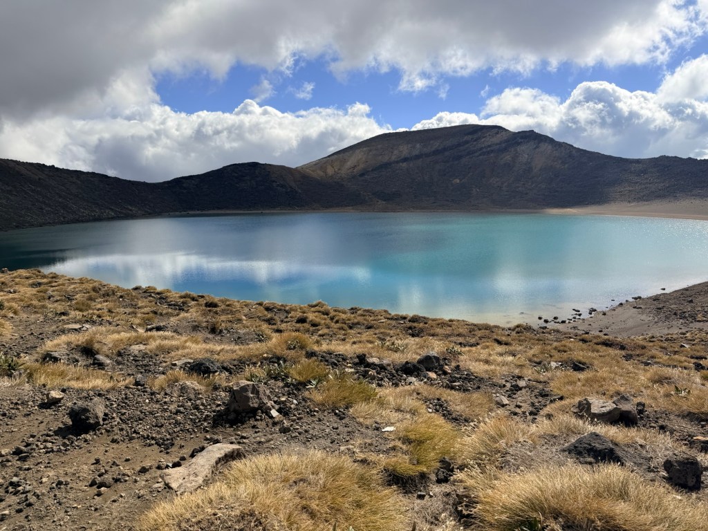
We came to Blue Lake where we ate lunch, admired the calm, and watched the water change colors and sparkle.
Look at the clouds reflected in the Blue Lake!🩵
Then we began the long descent down the other side. And when I say long, I mean long.
This section tests your endurance in a completely different way. It’s less intense, but it just keeps going. And going. And going.
My knees started negotiating. Our feet filed complaints. Brendan and I definitely hit the “are we there yet?” phase, more than once.
But the views opened up again, stretching out toward Lake Taupō in the distance, reminding us why we’re doing this hike.💙
🌄 The Finish Line
When you finally reach the end, there’s no dramatic finish line—just a quiet, deeply satisfying sense that you did something hard and worth every step. However, had there been “finisher medals” handed out, I would’ve kept that medal for the rest of my life and proudly displayed it in a prominent place! 🏅
We finished in just under 7 ½ hours, tired, dusty, and fully in awe of what we had just experienced.
Done!
🥪 What We Brought (and were very glad we did)
This is not a hike where you want to under-pack… but also not one where you want to wildly overdo it either (speaking from experience).
Water:
I carried 2 liters of water in my hydration backpack + a Powerade. I drank every last drop. Brendan carried 3 liters of water, a Gatorade, and two extra bottles of water. He only had those two extra bottles left at the end.
Equipment:
I used my new Leki hiking poles, which were absolute lifesavers on the downhill. They’re also easy to pack as they fold up very small and have a carrying bag. Brendan did not use poles but he’s also 30 years younger than me lol.
Even if you don’t have knee problems, it’s very common to have knee issues on the way down because your quads are so taxed and there are a million steps. OK, maybe not a million but it sure felt like it.
Food:
Our amazing hotel, Tongariro Crossing Lodge, packed us a perfect lunch—Ham and cheese sandwiches, chocolate, apple and granola bar. Plus we had some other snacks from a local gas station.
Clothing:
As mentioned above, I wore five layers, which, in hindsight, was aggressively unnecessary.😂 Better safe than sorry as some days may be colder.
Weather:
We couldn’t have asked for a better day. Other than the time we were actually in a cloud, it was mainly sunny. Keep in mind that you constantly need to be checking the weather up to the point when you hike, and then you may even have to turn around if the weather is too severe. Keep in mind that this hike is pretty wide open so sunscreen and hats are a must.
Also, we went through so many different biomes—volcanic, rolling hills, prairie, forest, jungle. I’ve never been on a hike, so diverse before.
Transportation:
Where are you start the hike and where you end it are two different places. Therefore, you don’t want to drive and leave your car at one end because you won’t have it when you finish.
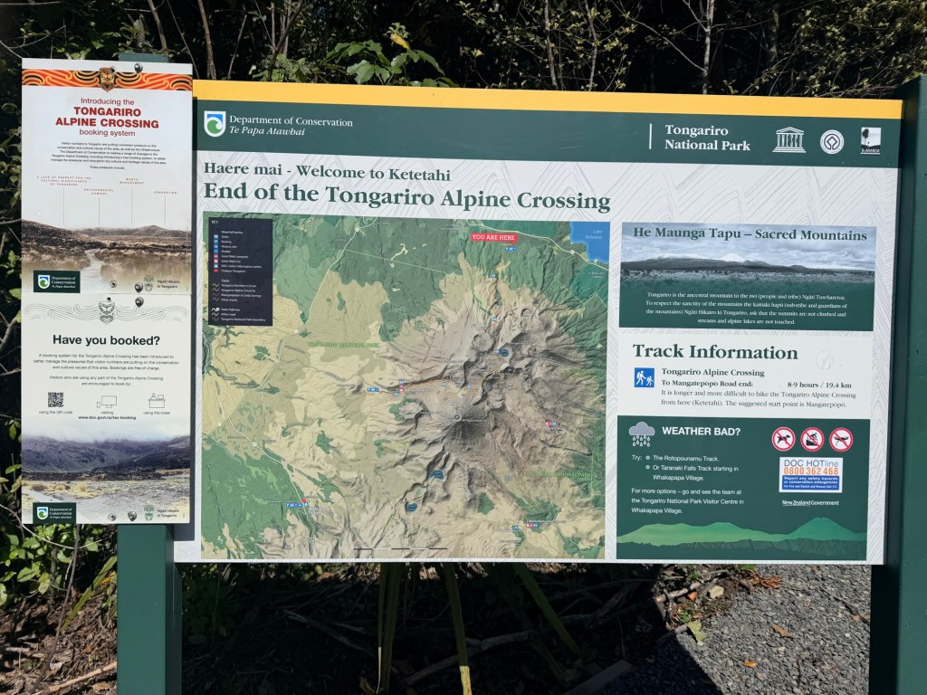
Therefore, our hotel booked us a ride both ways with Dempsey Buses. Worked perfectly. They picked us up at 6:45 am and then brought us back to the hotel when we finished. Pick up time is either 3:00 or 4:30 (or you call them and they’ll pick you up after). We made the 3:00 pm. And it was a good thing we did because we had a 4-hour drive to Wellington after we finished the hike.
Altitude:
Throughout the hike, we ascended 3,002 feet, we descended 4,170 feet, max elevation was 6,194 feet, and the minimum was 2,513 feet (thanks to Brendan’s Garmin watch).
Attitude:
Better bring a good one or that 6-8 hour hike will be miserable. Keep that positive mindset, think safety first, and enjoy the surprise around every corner.
🤔 Reflection
The Tongariro Alpine Crossing is physically demanding, mentally challenging, spiritually grounding, and visually surreal.
We came for the hike. We left with sore legs, incredible views, and a much deeper respect for the land we crossed. It was worth every ache and pain that, hopefully, Advil is going to cure.
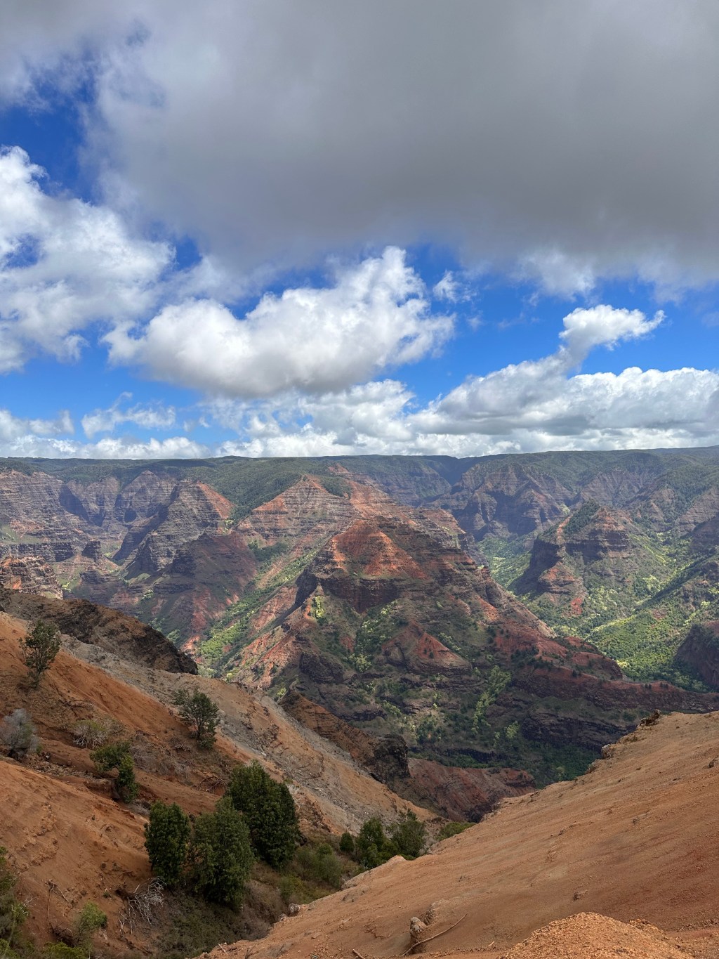
Also known as the Grand Canyon of the Pacific, Waimea Canyon is 14 miles long, 1 mile wide, and greater than 3,600 feet deep. The panoramic views are jaw dropping!
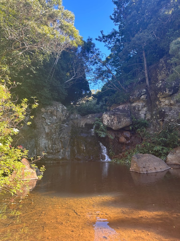
In addition to the scenic overlooks stops, we did a couple of hikes while in the park. The best was our 3 mile hike starting on the Canyon Trail and ending at Waipo’o Falls. FYI the Canyon Trail is a 12.9-mile out-and-back trail—we only walked a small part of it.
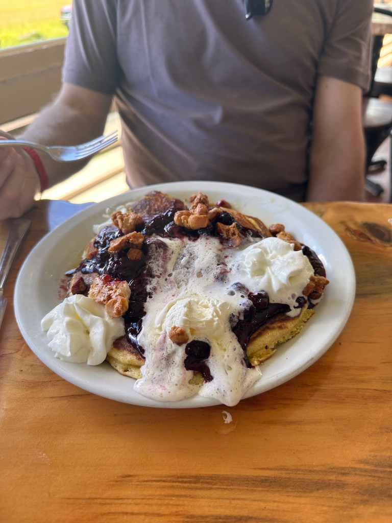
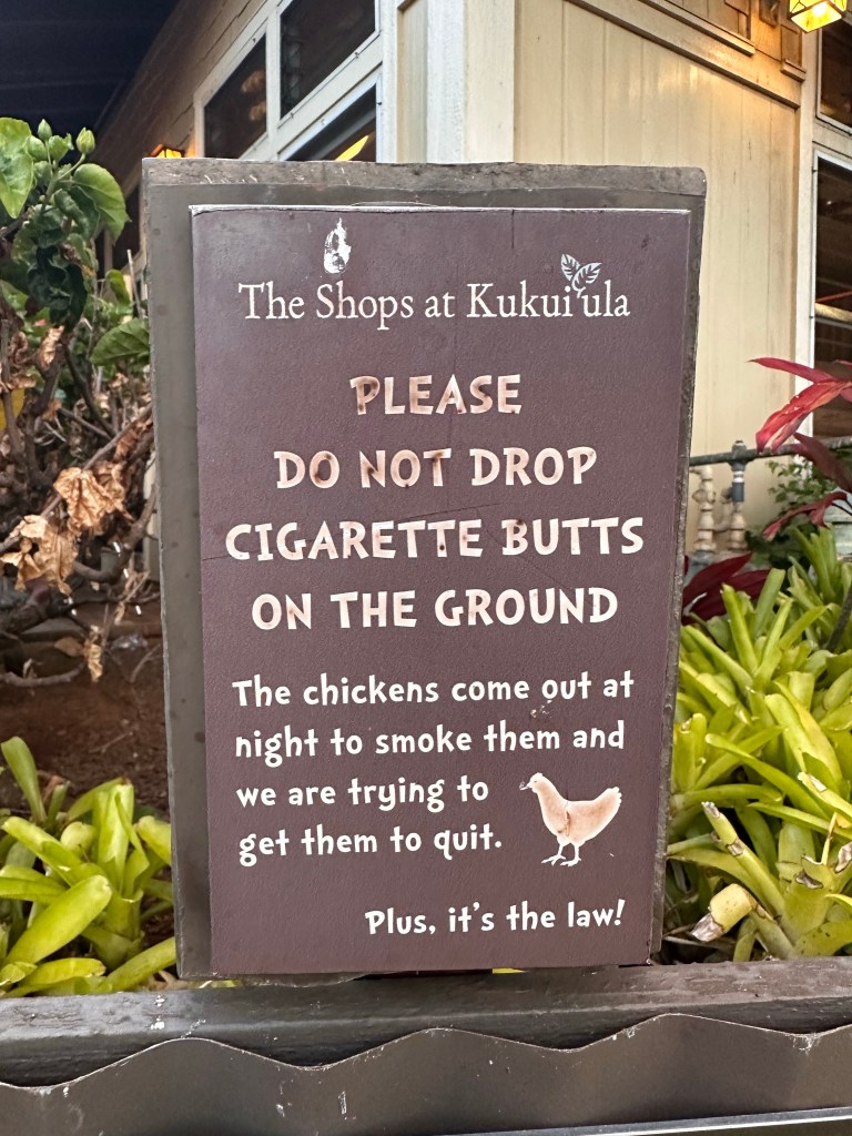
At times it felt like we were on Mars!At the bottom of Waipo’o Falls The famous (scrumptious) pancakes at the Koke’e Lodge after our hiking adventure.Back to the chickens — This was a sign at The Shops at Kukui‘ula. 🤣
This was the best week with my youngest son, Logan, exploring two national parks, hiking, and spending time together before he heads off for his senior year of college in August. Today is Memorial Day and I am not only reflecting on the trip but also on the sacrifices made by our service men and women — sacrifices that allow us the privilege of spending time freely in this beautiful country.
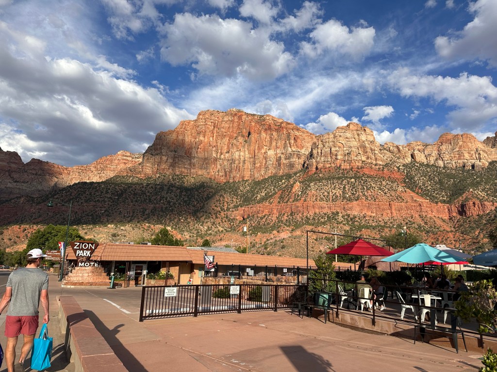
Location: Springdale, UT is the perfect base camp. It’s right outside Zion and it has everything you could possibly want—small town feel, really yummy restaurants, convenience / grocery stores, gear stores, ice cream (who doesn’t like ice cream every night on vacation??), and even spas. I walked into one of those spas yesterday after hiking and was able to get a massage. The Spa at Cable Mountain Lodge is fantastic—jacuzzi, steam room, and a relaxing massage (thanks, Scott!). Highly recommend this place to soothe those tired hiking muscles. I feel like a new person today!
Sitting on the patio and listening to the Virgin River
Also, fellow Birkenstock fans—Simply Birkenstocks has Birks I didn’t even know existed and they ship too (don’t ask me how I know that). Also, they carry other shoe brands (Teva, Chacos, Naot, etc) and gear/clothing that you may have forgotten to pack—like Vuori and Kuhl.
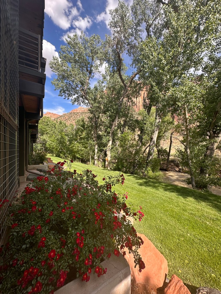
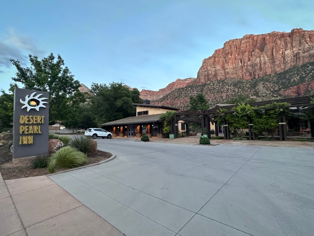
We stayed at the Desert Pearl Inn. I will write a Trip Advisor review shortly and link it here. It was everything we thought it would be and more. The pool and hot tub were nice after a long day of hiking. Our room was clean and modern. We backed to the Virgin River—the river was right out our back door. It was so darned relaxing to sit on the patio (we were ground level) and watch/listen to the water every morning/evening. That river moves fast! We had one small issue with a smell in the bathroom but they were quick to fix it for us.
The weather couldn’t have been better—sunny, 70s/80s and no humidity. In the morning it was actually chilly and when the sun sets, it’s extremely pleasant. I could get used to weather like this!
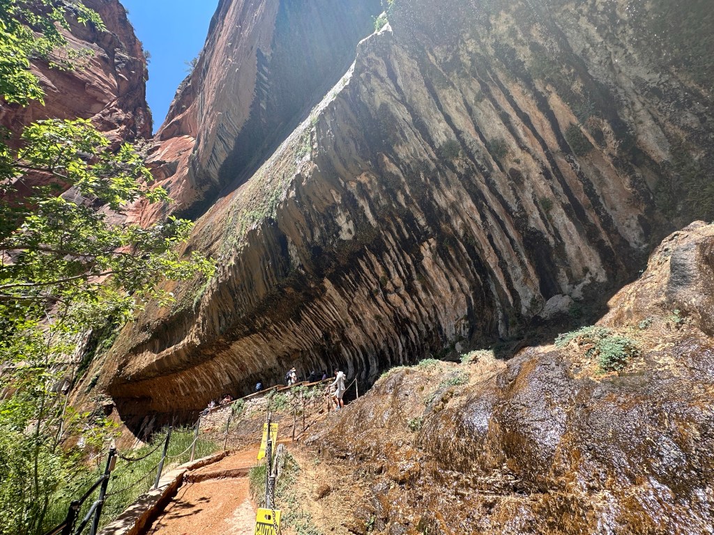
Yesterday was another full day of hiking. During this trip we did every major hike in Zion we could, other than 3 that were closed due to rock slides/high water. Unfortunately, The Narrows was the one closed due to high water. Oh well…gives us another reason to come back! We enjoyed the Riverside Walk Trail that follows the Virgin River and took us to the start of The Narrows. We also hiked the Pa’rus and Weeping Rock Trails. We walked from Canyon Junction to the Court of the Patriarchs where we took the shuttle to the Zion Lodge and ate lunch. Good lunch but not as good as the Lodge at Bryce Canyon.
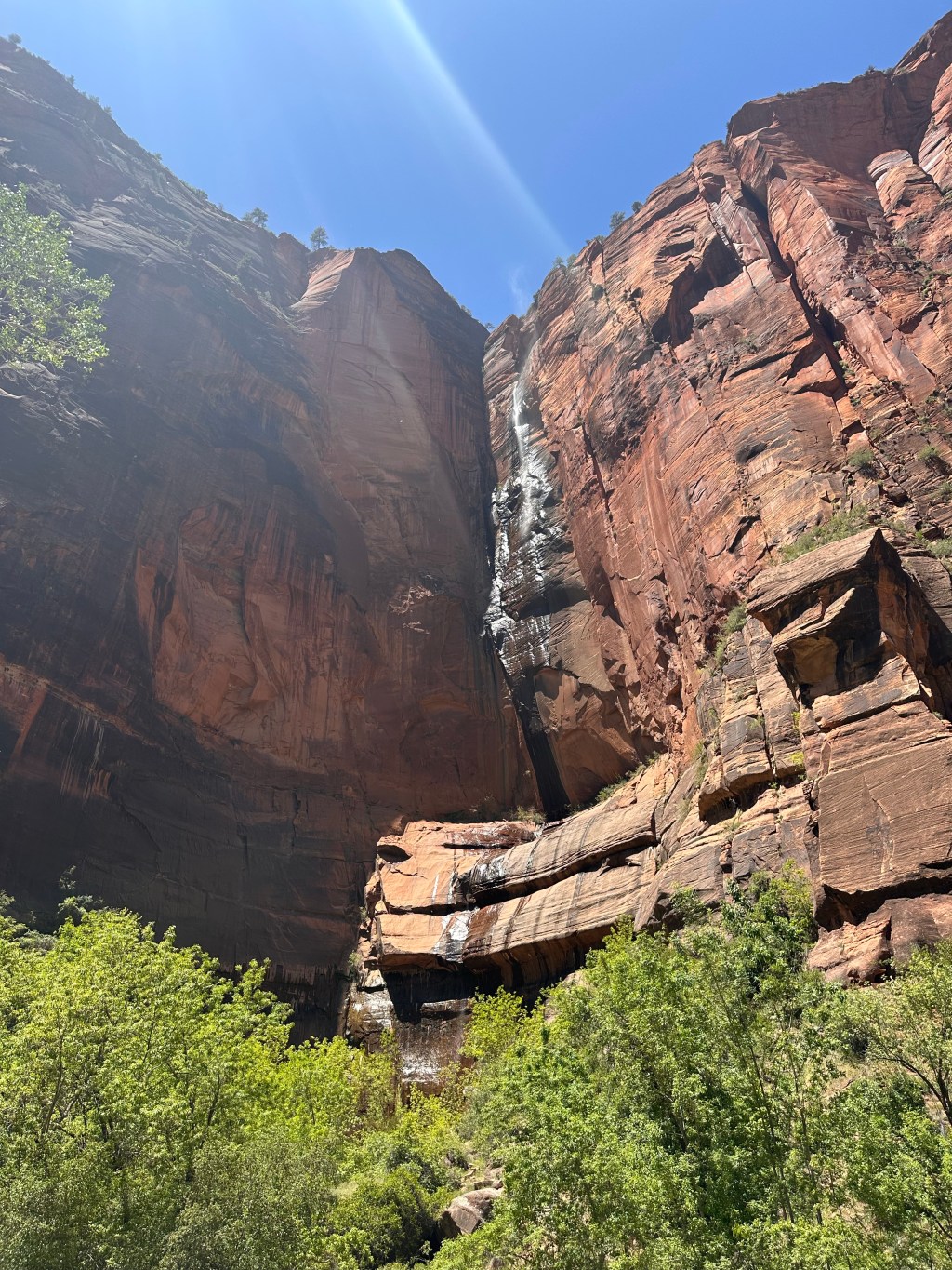
Riverside Walk Trail – a 2.2 mile (out and back) paved trail that leads to the start of The NarrowsA waterfall along the Riverside Walk Trail on another beautiful cloudless day ☀️ The Weeping Rock — a little oasis in the middle of the desert! It starts with melting snow and rain as the water travels down the Navajo sandstone. At some point, the water cannot pass through the rock so it starts to come out the side of the cliff, forming a spring! The Weeping Rock as we hiked up to it
Last evening I had THE BEST spaghetti squash enchiladas at Whiptale Grill. In fact, it’s the only time I have ever had spaghetti squash enchiladas but I know I will crave them from here on out. Logan and I agreed that this restaurant and Oscar’s Cafe were our favorites. Check out Oscar’s Pork Chili Verde Tamales and the Salmon Filet.
Goodbye Zion. We loved every minute with you. We felt your truly awesome creativity and force with all of our senses. Thank you for the experiences and memories. 🧡💚
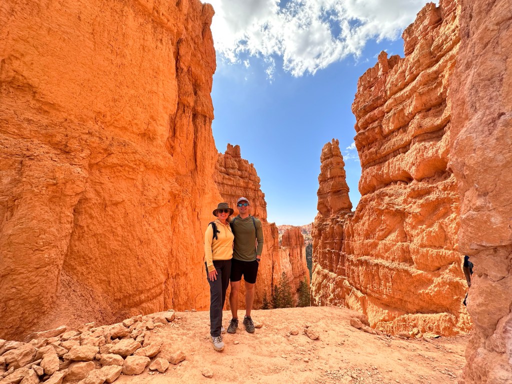
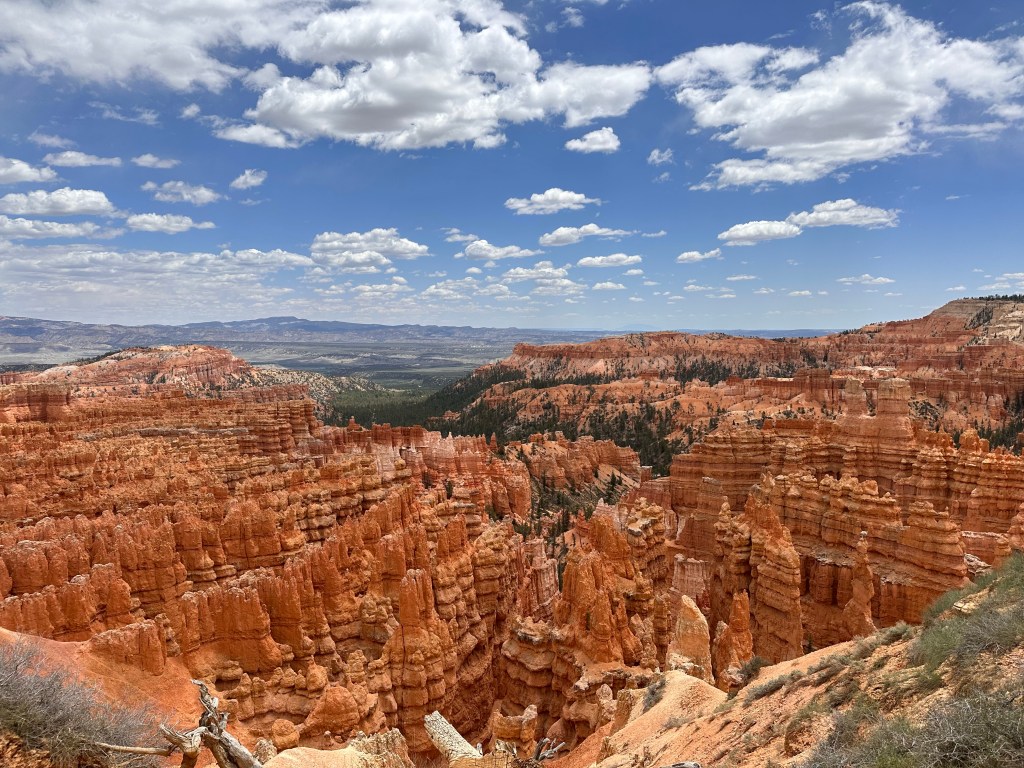
We struggled with making a decision. Do we drive two hours to go to Bryce Canyon National Park today or do we stay in Zion? We had many recommendations to go and so we thought, let’s do it! BEST DECISION!! Bryce Canyon, or BC (which I will affectionally call it), was beyond our wildest imagination. It’s something right out of fantasyland. They even have a Canyon named Fairyland! Whether you see chess pieces ♟️ or other mythical creatures, BC was like a sugar craving. You know when you open a candy bar and say, “I am just going to have 1 square and save the rest for later”? Then next thing you know, the entire bar is gone. That was how we felt about these rocks. We couldn’t just see 1 — we wanted to see them all! I have over 500 pictures and videos from today…I know, it’s over the top but so worth it.
The “rocks” are actually called Hoodoos and BC has the greatest Hoodoo collection in the world. And, the perfect climate, too, with the right balance of freezing and thawing to create them.
So many pictures and not one can do this justice
We started our drive through Zion National Park (Hwy 9) at 6:30 am, going through the historic 1.1 mile long Zion-Mount Carmel tunnel, which provides direct access for travel between Bryce Canyon, Grand Canyon, and Zion National Parks. In about 1 hour 50 minutes, we arrived at BC and started hiking at the Bryce Point trailhead (Elevation 8,300). We walked the Rim Trail, stopping at various points, including Inspiration Point, Sunset Point, and Sunrise Point. This led us to the Navajo Loop, taking us down to the Amphitheater (the floor) where we could hike amongst the Hoodoos. We joined up with the Queen’s Garden Trail, which brought us back to the top. I find it much more difficult to hike canyons—what goes down, has to come back up! I’d rather do the hardest part first.
Hiking with the Hoodoos
We then ate a really delicious lunch at the rustic Bryce Canyon Lodge. It’s been in operation since 1925 and designed by the famous architect, Gilbert Stanley Underwood. I had a Reuben on a GF bun—one of the best Reubens! We shared some garlic parmesan fries, which were also yummy. Maybe I was just really hungry from the hikes?
After lunch we hiked back along the Rim Trail, saw some deer that didn’t seem fazed by us, and made a quick stop by Fairyland Canyon on our way out.
Next time I would add another day for BC. Night time star gazing is supposed to be amazing. Also, there are a couple of other hikes we didn’t have time for in one day. I would love to see the shifting colors of the Hoodoos with sunrise and sunset.
Naming all the Hoodoos (although some of the more famous ones have names – Thor’s Hammer, The Hunter, Queen Victoria)
Let’s talk a little more about the Hoodoos, because they are fascinating. They don’t grow out of the ground. Rather, they are eroded out of cliffs. Rows of narrow walls form calls fins. Then cracks occur and holes appear. The fins now have windows. As the windows get bigger, the tops eventually collapse and ta da—a baby hoodoo is born. Rain/snow act like a sculptors and make the hoodoo look like you see in the pictures—a bulbous spire. They have their lifespan and eventually break down into lumps of clay while new Hoodoos are born.
Picture perfect day with temperatures in the low 60s (Fahrenheit).
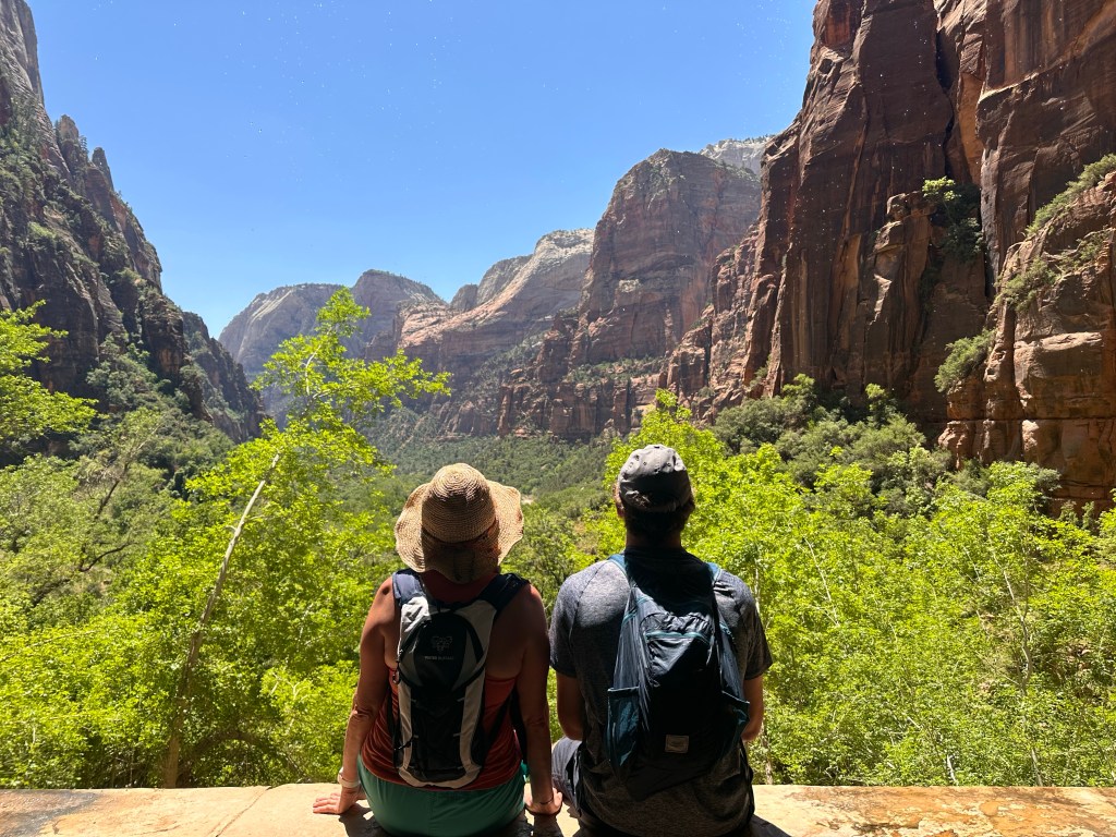
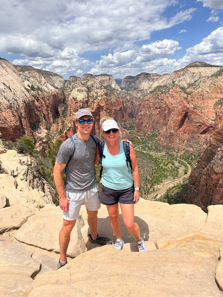
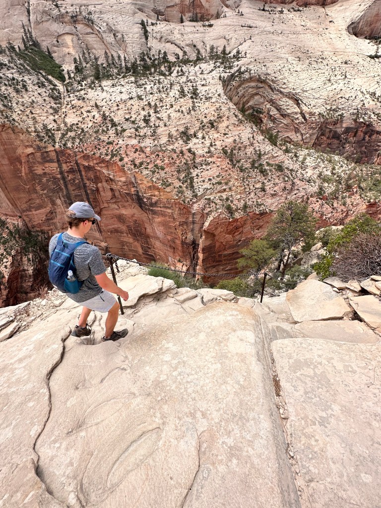
We did it! Well…I did it. Not sure there was ever any question my son couldn’t do it🤣
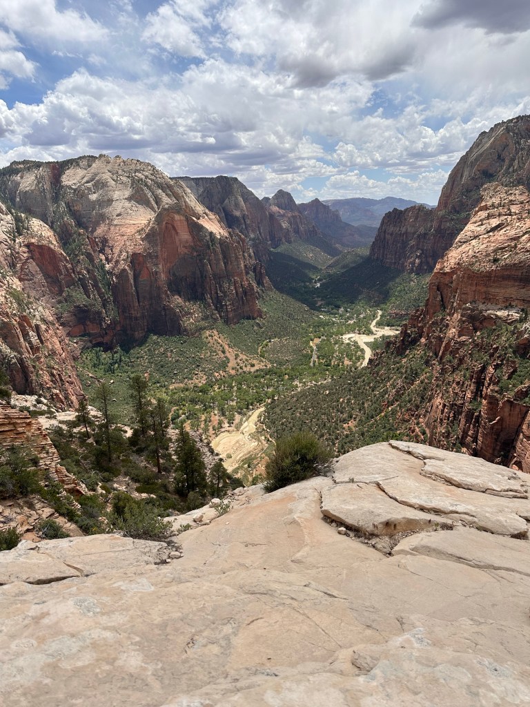
“It” means hiking Angels Landing, a 1,488-foot tall rock formation in Zion National Park. It stands 5,790 feet tall and provides the most amazing, surreal views of the canyon. It literally took my breath away!
This was by far the HARDEST 4 hour hike (5 miles out and back) I have ever done. 21 switch backs called Walter’s Wiggles, 1,500 foot elevation gain, and then we got on (what I call) “the chains course” for the longest last 1/2 mile of my life. You now need a permit to hike Angels Landing and we were the lucky lottery winners for today. I highly recommend this hike for adventure seekers but not for anyone fearful of heights or with two left feet! You can hear my out-of-breathe narration below if you want to add to your hiking bucket list.
☀️☀️☀️☀️☀️☀️☀️☀️☀️☀️☀️☀️At the top!The weather was perfect—sunny and high 70s (Fahrenheit)
We found out it’s called Angel’s Landing because a Methodist minister, Frederick Vining Fisher, once said that because it’s so massive that only angels might land on it. It’s indeed tall at 5,770 feet with rock from the Jurassic period. The trail is rated as one of the most dangerous hikes in the USA. There are no guard rails and 14 people have died due to falls. We played it safe in all ways – sunscreen + light weight clothing, plenty of water and snacks, took our time, used the chains, stayed away from the edges, and followed the rules of the park. Also, I didn’t take any photos/videos unless I was on a plateau or at a safe stopping point. Call me cautious but I wanted to write this post!
Angels Landing used to be a very congested trail, thus the reason for the lottery, which designated our date and start time. Make sure you check the park’s website for details – they have a season lottery (which we did) or a day before lottery.
As I write this I can barely stand. That’s what happens when I try to keep up with my athlete son who is 23! Almost 12 miles. Almost 28,000 steps. 60 flights climbed. My legs are screaming!
Here’s me and my legs before they were screaming
We started our day at about 8:00 am with the Watchman Trail. Elevation gain was around 650 feet and the sun wasn’t too bad since it was early and partly shaded. The wildflowers were abundant and added that little something extra to the hike.
At the end of Watchman Trail
Right now you cannot drive your car into Zion National Park. They have a well-oiled bus system that makes 9 stops throughout the park, starting at the visitors center and ending at the Temple of Sinowava (The Narrows, Riverside Walk). And there’s another bus line that makes 9 steps in Springdale, UT and takes you into the park at Zion Canyon Village so that you don’t have to drive at all. It’s an outstanding free perk! Stop 4 is right outside our hotel. That said, it’s only .9 miles to the visitor’s center so we walked there this morning, and then walked home.
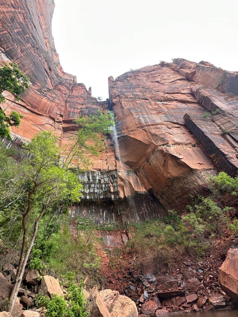
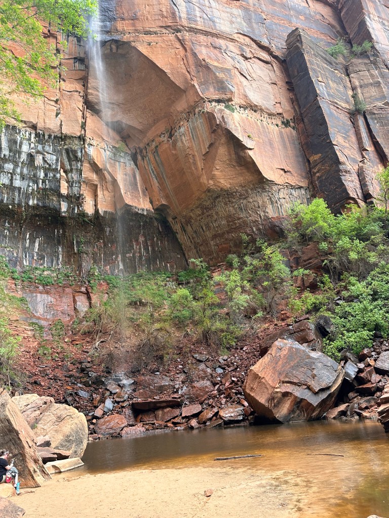
After completing the Watchman Trail, we hopped on the bus and then took The Grotto to Kayenta Trail and then on to the Emerald Pools Trails (lower, middle and upper). Another elevation gain of about 650 feet. Gorgeous waterfalls and hanging gardens. And the rocks! I said to my son, “gosh, these rocks never get old” and that smartie says “But they are old, Mom—they’re 270 million years old!” Ba-dum-bump.
The Virgin River may not look like much, but it’s mighty enough to continue to erode through this canyon, shaping and carving what you see here!The lower Emerald Pool Cooling off from the waterfall sprayThe upper Emerald PoolAnother view of the gorgeous upper Emerald Pool Lots of sand in the shoes in this hike
We ate lunch after hiking at Cafe Soleil, a cute little breakfast, lunch and coffee shop that caters to hikers with smoothies and fresh food. Lots of gluten free options, including bread. For gluten free folks, it’s always a nice surprise when we can have a sandwich! Dinner was MeMe’s Cafe where we sat outside and enjoyed delicious homemade crepes (also had gluten free batter for the crepes).
Now it’s time for bed because tomorrow is a hike we’re been waiting to do for years!
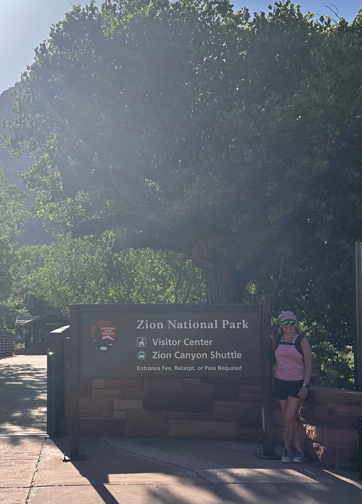
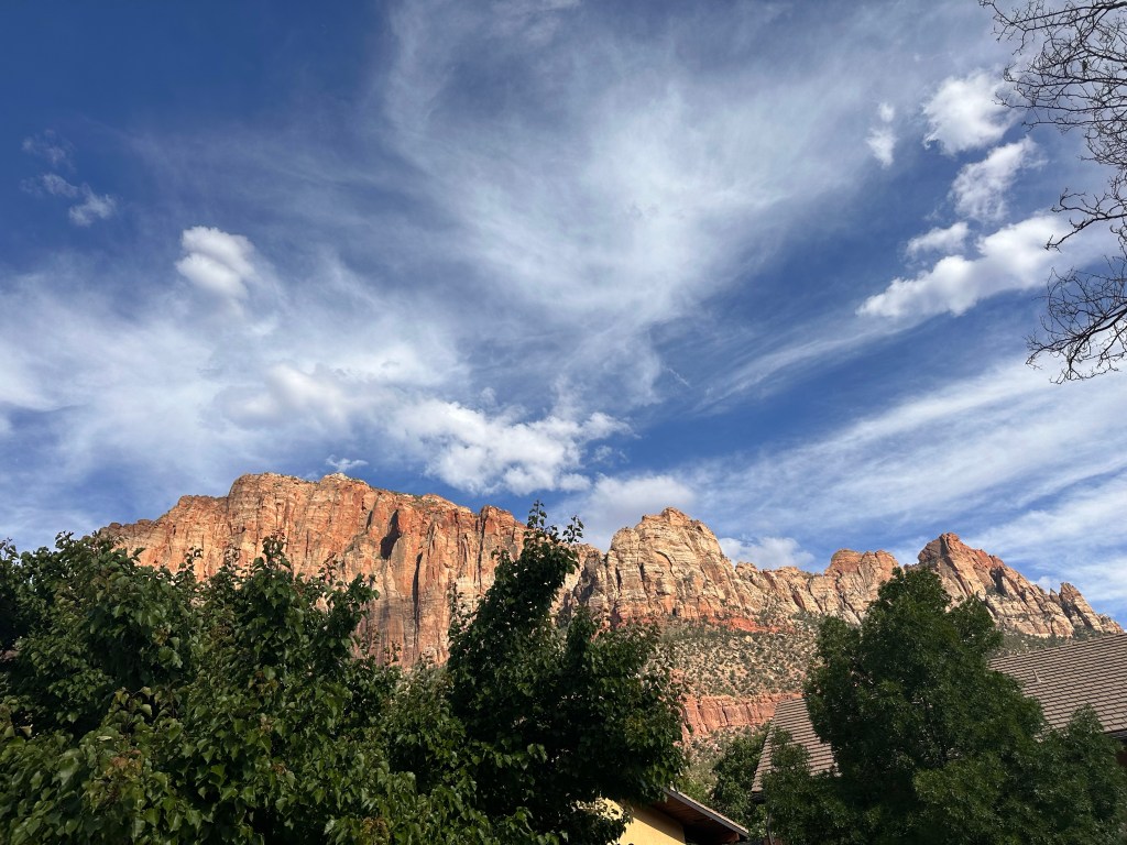
After landing in Las Vegas, we rented a car for the 3 hour drive to Southwest Utah. We arrived at a breathtaking place called Zion National Park, found at the junction of the Colorado Plateau, Great Basin, and Mojave Desert regions. We’ve here for the long Memorial Day weekend, filled with hiking, hiking, and more hiking. Oh and lots of people. Last year during this same weekend Zion saw 82,000 people! I guess you can say it’s the calm before the swarm (of people).
I was curious as to what “Zion” means — and I found many answers: “highest point”, “utopia”, “holy place”, “Israel”, “heaven”. Our view just walking down the street! My son is with me on this trip because we are both hiking aficionadosThe honeysuckle! One of my favorite smells.💛Springdale, UT is charming, the resort is comfortable, and the Virgin River is out our back door. We had some really yummy rotisserie chicken for dinner from Camp Outpost (along with sweet potato hummus)
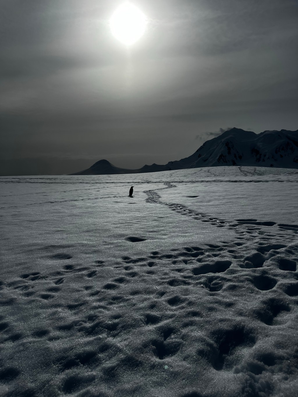
Useful Island is covered with Gentoo Penguins colonies and we had so much fun watching them! Here are some videos from that day—always maintaining our 5 meter distance except when one crossed in front of us and I had no where else to go except to stand still (as I was hiking up a hill). I know that some of my narrative isn’t all that great but these little penguins rendered me speechless!
Welcome to Useful Island!
Home of Gentoo Penguin colonies
This is a stand off between a Gentoo Penguin and the Skua bird. These birds are known for two things—stealing Penguin eggs and eating baby chicks.
We were hiking up the island to see the Chinstrap rookery when these two Gentoo penguins decided to cross my path. It’s very important that we stay on our path and I could not turn around as there were people behind me. So I just stayed still and let them cross.